The moment I learned about the Everglades Wilderness Waterway last winter, I knew I needed to go. This 99-mile paddle route promised unique camping experiences, encounters with incredible wildlife, top notch fishing, solitude, and adventure.
I was well aware that such a journey would demand meticulous preparation. While my previous wilderness experiences leaned heavily toward backpacking, I felt a bit like a novice in the realm of long-distance kayaking. Nevertheless, armed with a commitment to readiness, I was confident I could conquer the challenge!
I returned from the trip a few days ago and I will tell you it was incredible. In a later post I will recount the actual journey, but in this entry I wanted to describe how I prepared for the trip. For me, half the fun of an adventure is the planning and anticipation.
Route
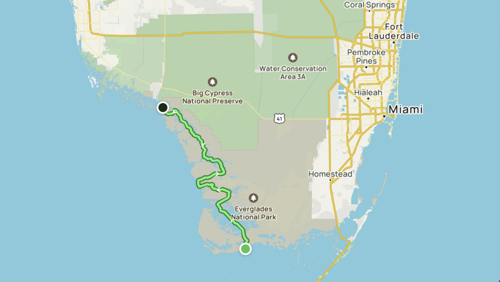
The Everglades Wilderness Waterway is a route through rivers, bays, and creeks from Flamingo at the southern tip of the Florida Peninsula to Everglades City at the northwest corner of the National Park.
Under the advice of a local fishing guide, I planned to go South to North, matching the direction of the typical prevailing winds.
I decided to aim for around 15 miles a day. I could probably manage up to 20 miles in a day, but certain sections would require timing the tides to not get stuck at low tide. With the short December days, I did not want to risk running out of daylight, so roughly 15 miles seemed like a good goal. I picked my campsites accordingly.
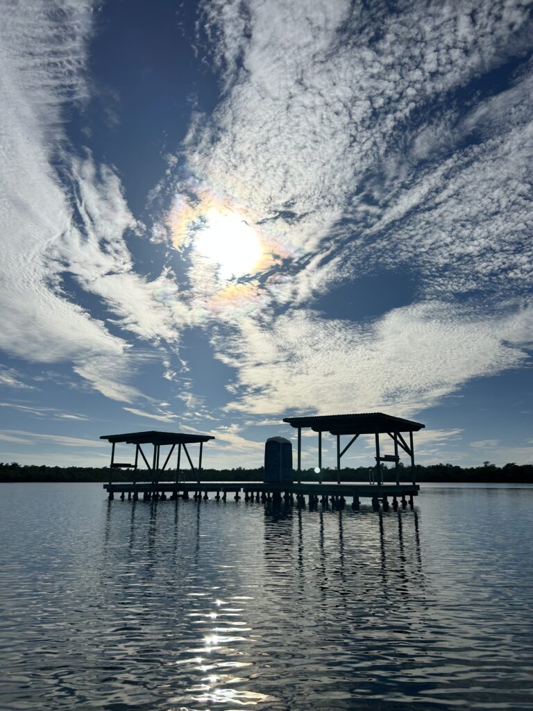
Though there are a few ground sites along the route, I opted to camp primarily on chickees. Chickees are wooden platforms constructed on pilings over the water where you can moor your kayak and set up your tent on the deck. The word chickee comes from the Seminoles, native to Florida, who constructed open-sided structures with thatched roofs on the water.
I wanted to see the Gulf of Mexico, so I planned one side trip off the waterway to visit the beach. I planned to take a full day on Highland Beach to relax, fish, and enjoy the Gulf coast. Adding a “zero” day also gave me some flexibility in case I got behind schedule or had to wait for bad weather to pass.
To camp in the Everglades, backcountry permits and reservations must be made online. I had no trouble getting all the campsites and dates I wanted. The permit for nine days cost $37.
Season
The Everglades has a wet season in summer and dry season in winter. With clear skies, lower temperatures, and fewer bugs, winter is considered the best time to paddle the Glades. As I have some time to kill between big thru-hikes this winter, December was the perfect time for this trip.
Kayak
I took my Hobie Compass, a 12 foot fishing kayak. The Hobie is powered by a foot pedal drive instead of a traditional kayak paddle, thus keeping your hands and arms free for fishing. I generally use my Hobie for fishing around my home in Virginia Beach, but I thought it would be a great option for a long-distance camping trip as well.
The kayak is propelled by pedaling, kind of like a recumbent bicycle. The powerful pedal drive would allow me to cover miles efficiently. Using my legs instead of my arms, I can travel long distances quickly and quietly without getting fatigued. The kayak’s rudder would also help me maintain control in strong current and winds across open water, and aid on the tight turns of small twisting creeks.
Food and Water
Although I was going to be on the water 24/7, there is no drinkable water on the Waterway. All of the water is either salt or brackish. Filtering and/or treatmentis ineffective on salt water, so all of my drinking water for the whole trip would need to be packed. The National Park recommends carrying at least a gallon per person per day, which is exactly what I packed: 8.5 gallons for 8.5 days.
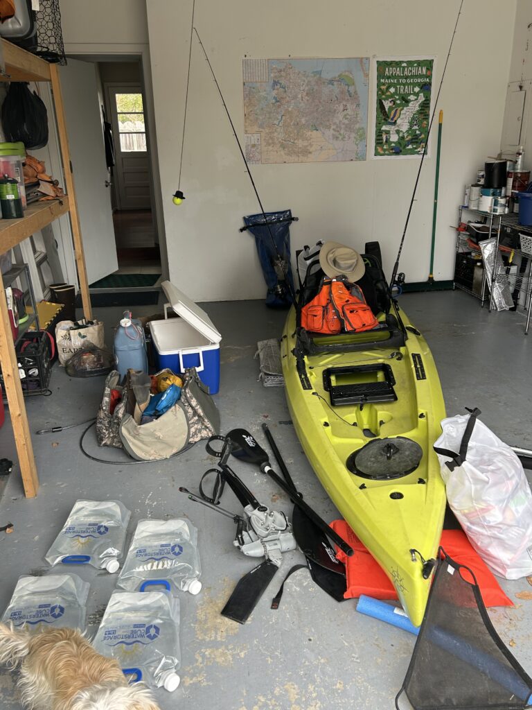
Finding a way to pack all of that water (68 pounds!) was another matter. Instead of one large water vessel, which would be clunky and hard to fit in the kayak, I packed water in small 1/2 or 1 gallon jugs. With the smaller containers, I could fit all the water into nooks and crannies in the hull of the kayak, maximizing space and better distributing the weight.
Gear
Similar to my approach to backpacking, I wanted to keep my gear load as light and minimalist as possible. However, a water trip meant I would need paddling and fishing supplies, in addition to the usual camping gear.
Between my gear, 8.5 days of food and water, and my own body weight, my kayak would need to carry about 285 pounds, comfortably under the 400 pound weight capacity, but still a hefty load to paddle.
I put a lot of thought into how I would load all my gear, listed below, onto my kayak. Camping gear needed to stay dry and out of the way. Fishing and paddling gear needed to be accessible, but not clutter up my limited space. I added a larger hatch to my kayak and in the days leading up to my trip, practiced loading up the boat, experimenting with different ways to organize my equipment. I felt that investing the time to perfect my set-up at home would make my life easier on the water.
Camping gear
- Tent
- Light sleeping bag
- Sleeping Pad
- Bungee cords – to secure tent to chickee posts (you can’t use stakes on the wooden platform)
- First aid kit
- Headlamp
- Toiletries
- Kindle
- Repair kit
- Power banks and charging cables for electronics
Fishing gear
I wanted to take advantage of the world-class fishing in the Everglades, but with space at a premium on the kayak, I decided to take a minimalist approach. I planned to only use one technique — artificial paddle tail lures on 1/4 jig heads.
- Rod
- Extra line
- 1/4 oz jig heads
- Several packs of paddletail lures
- Pliers
- Measuring tape
- Pocket knife
Paddling Supplies
- PFD
- Whistle
- Small anchor
- Bailer – 1/2 gallon jug with top cut off
- Bow and stern lights – to paddle at night if needed
- Dock line – to secure kayak to chickees
Clothes
- Long pants and long sleeve shirt – for sun and bug protection
- Neck gator – for sun and bug protection
- Sun hat
- T shirt – for sleeping
- Old sneakers – to use like water shoes
- Warm layers – fleece, long underwear, and socks
- Raincoat – also good as a wind breaker
Cooking
- Backpacking stove and fuel
- Small cook pot
- Small frying pan – to cook fish
- Filet knife and cutting board – to prepare fish
Day bag
- Bug spray
- Sunscreen
- Binoculars
- Sunglasses
- Bug net
- Headphones
- Small towel
- Paper maps and compass
- Guidebook
- Tide charts
Navigation
Another concern was finding my way. Navigating a long distance hiking trail like the AT is easy – you just follow the trail.
The Everglades on the other hand is a complex labyrinth of mangrove islands, open bays, small twisting creeks, and large rivers. Though the Waterway is marked with numbered posts, it is often miles between markers. It would be very easy to get lost in the Everglades. Moreover, there is no cell phone coverage in this area.
If you get off track and can’t find your chickee, there is nowhere to camp. The shoreline along is almost entirely mangrove forest. Mangroves islands are an interlocked network of roots, with no real ground to walk on or set up a tent.
I was therefore determined to not get lost and brought multiple navigation methods. Though it was somewhat redundant, each navigational method had its own strengths, and I felt secure having multiple backups.
- Gaia – Navigation app with downloadable maps for offline use. It had the Waterway and campsites marked, but lacked nautical information such as water depth and channel markers.
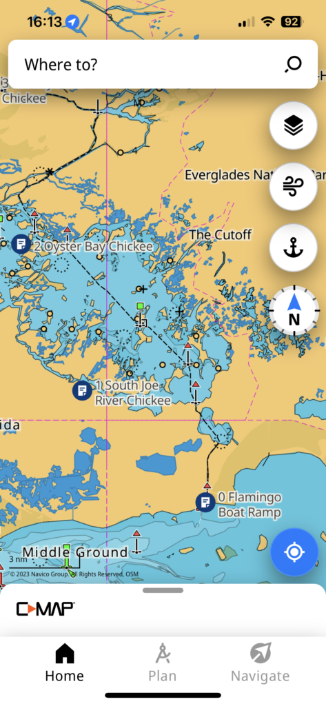
- C-Map – Nautical navigation app. Opposite to Gaia, it had the nautical information but did not have the Waterway marked.
- Garmin Explore – Another navigation app with downloadable maps. The maps were not as detailed as Gaia or C-Map, but this one synched to my Garmin inReach.
- inReach – A satellite communicator for emergency messaging and navigation. Though not as user-friendly as a phone app, I could navigate using the small display on the device if my phone died or failed. Using the Garmin Explore app, I created my route ahead of time to download it to the inReach.
- Paper maps and compass – NOAA charts 11430, 11432, and 11433 cover the Waterway. If all technology failed, I could navigate the old fashioned way. There are hundreds of different symbols on nautical charts, and I spent some time reviewing them. I am far from proficient, but I got the basics.
- Guidebook – Paddling the Everglades Wilderness Waterway by Genzen and Sullivan. Contained verbal descriptions of the route and rudimentary maps.
Yes, that’s six different ways to navigate!
Logistics
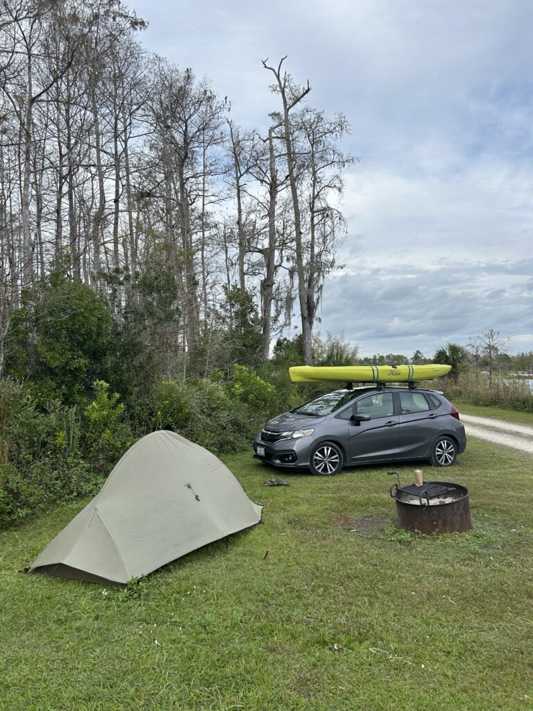
Since I wanted to bring my own kayak, I decided to drive from Virginia to the Everglades, with the kayak strapped to the roof of my car.
I planned to leave me car at the end point in Everglades City and hire a local fishing guide to shuttle me and my kayak the 3 hours from there to my start point in Flamingo.
Planning a wilderness trip can be hard work, but it’s part of the fun. In the process of prepping for the Everglades I learned about the area’s unique ecosystems and wildlife, about marine navigation and tidal patterns. I got to play with all my toys in the garage, and I got to daydream about the adventure to come.
Stay tuned for a post describing how it all turned out!

Hi Kirby! This blows my mind! Andrea’s Dad would be so proud of you! Great job! Meriel
I am already impressed! I can hardly wait for the next post!